The Fairfield Association have maintained a photographic survey of the reserve since 2015. Photographs are taken on 5 occasions each year: March, mid-May, late June, early August and late September.
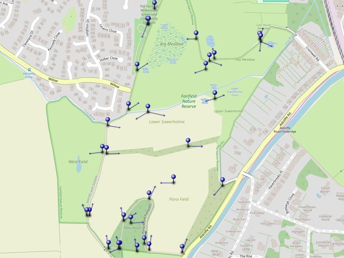
Click/tap anywhere on the map to open it
When the map is open, just select a specific marker for a link to the photograph album for that view. (The “i” icon for each photograph brings up the date the photograph was taken.)
Alternative to using the map
You can also access the albums for each area by using the links below.