Background
The 1840 map of Lancaster shows the field as part of the Aldcliffe demesne with no land divisions in place. By the 1890s the map has field boundaries marked as well as the small patch of woodland in place so it seems that at some point between 1840 and 1890 the field started, or resumed, agricultural use.
There is a ‘stone’ marked on the 1890 map in the west of the field, but precisely what that was is unclear and there is no sign of it today. The 1910 map shows the field divided into smaller fields again suggesting more intense land use.
Fieldwalking
The field was ploughed in April 2015 and was subsequently fieldwalked after ploughing and harrowing to look for archaeological objects brought up by the plough. We used a standard fieldwalking methodology and the volunteers walked in a line across transects of the field at five metre intervals. This is sufficient for identifying archaeological sites.
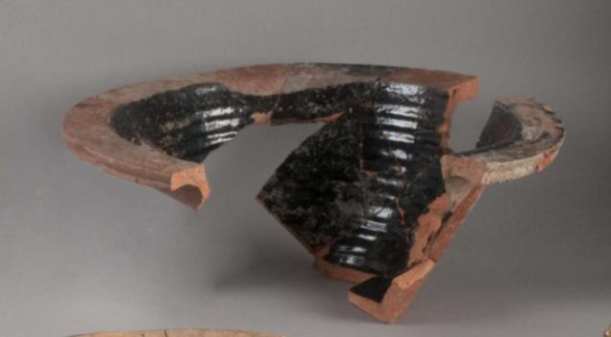
We found a mass of predominately 19th and probably early 20th century pottery. Some pottery may be earlier. The pottery was all broken and represents the addition of kitchen waste onto the fields which was standard practice prior to modern rubbish collection regimes. We also found a number of clay pipes, both stems and a couple of bowls. Clay tobacco pipes were manufactured in Lancaster and so these fragments are likely to be local in origin. We also found, but did not keep, small lumps of coal. Some of the pottery resembles Buckley Ware, which was produced into the twentieth century.
No prehistoric or early historic archaeological material was recovered from the field. The location of a spring within the field and Lucy Brook to the north means it is likely this was a marshy area prior to land drainage for agriculture in recent times. The name of the nearby farm (Carr House Farm) further supports this argument, a carr being an area of land which is waterlogged or marshy. The report of two Neolithic stone axes from this area is not unusual as they were often deposited in watery areas or bogs. It is unlikely, therefore, that they represent occupation in the immediate area.
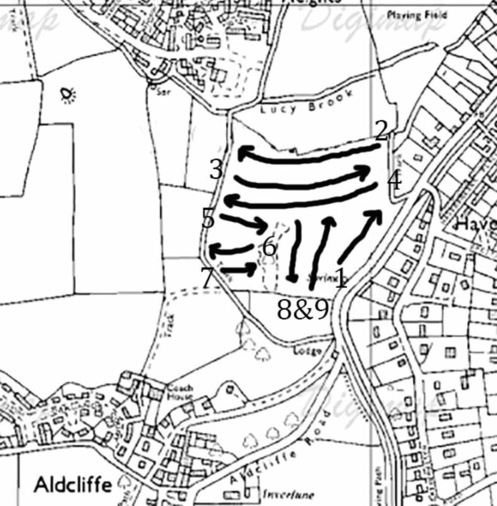
This marks the transects we walked over the field and relates to the numbering system on the finds bags. I don’t think I labelled 8 and 9.
Vicki Cummings