Big Meadow
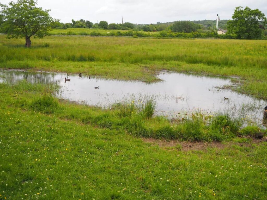
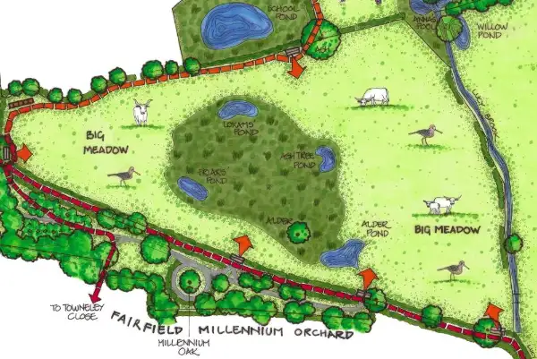
Big Meadow is a 4ha/10 acre field on the left of the Fauna path approaching The Orchard.
History
- Farmers in the past drained this marshy land and contained the brook into a steep sided channel, leading to a culvert.
- The reduction of wetland around the Lancaster and Aldcliffe area has been detrimental to wildlife, in particular wading birds.
Since 2012
- We have converted the area into a “wet pasture” by breaking up the field drains, thus creating a habitat for over-wintering snipe.
- These birds breed in the uplands and spend the winter by the coast where they need tussocky patches, such as the soft rush ( juncus), in which to hide and damp grassy patches to feed.
Current Features
- Inside the soft rush are open areas comprising a patchwork of grass and moss, ideal for snipe to feed. The moss absorbs water and locks in carbon.
- There are 4 ponds: the largest, Alder Pond is close to the path, Loxam’s, Friar’s and Ash Tree are hidden in the rush.
- An old alder tree stands by Alder Pond.
- In the winter there may be 100 snipe, both common snipe and jack snipe hidden in the rushes.
- White Park cattle.
Maintenance
- We manage the water level by adjusting the height of the pipe in Alder Pond. If the field becomes too wet, water is allowed to run out of the pond towards Lucy Brook.
- Once a month in winter, volunteers walk through the rushes, flushing and counting the snipe.
- White Park cattle, are moved around the reserve, keeping the grass low and breaking up the rush.
- Some ragwort is removed, but not all, as this is a valuable plant for a large number of invertebrates, especially the cinnabar moth caterpillar.
Future
- No changes are planned currently.
Photographic Survey
The Fairfield Association have maintained a photographic survey of the reserve since 2015. Photographs have been taken on roughly 5 occasions each year: March, mid-May, late June, early August and late September.
Each album is arranged in date order. To find out the specific date particular photos were taken, first select the photo and then select the ‘i’ icon in the top-right of screen. (All albums launch in a new window.)


