Triangle Maps and Plans
Location
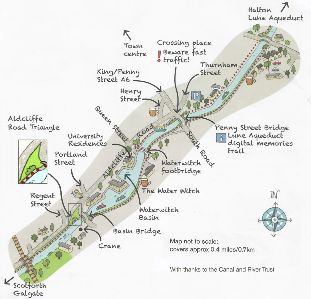
The Triangle is situated in the south side of Lancaster city centre near to the Lancaster Canal. The nearest postcode to the entrance is LA1 1SH. There is no parking (or toilets) available and visitors by car are advised to park at the Thurnham Street car park, 500m north east of the Triangle along the canal.
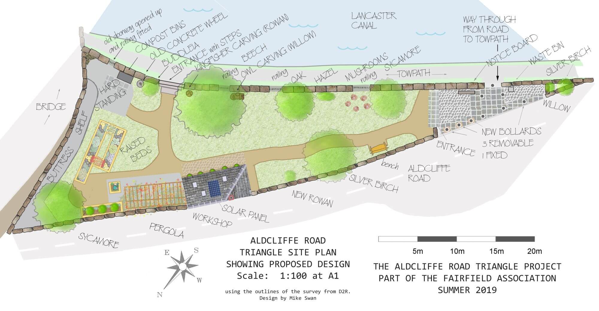
Current layout
Planting scheme
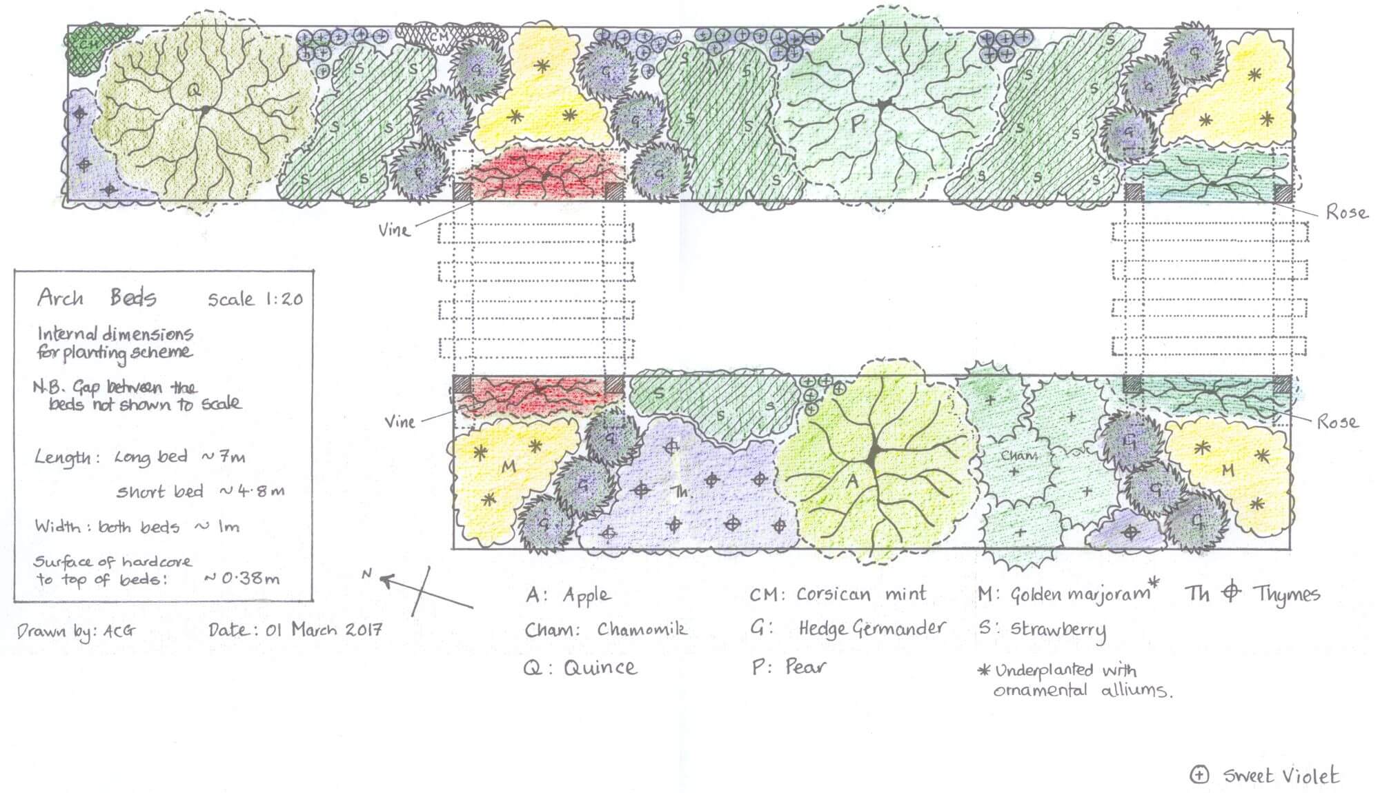
There is also a PDF document with detailed information about the planting scheme.
Development of the site
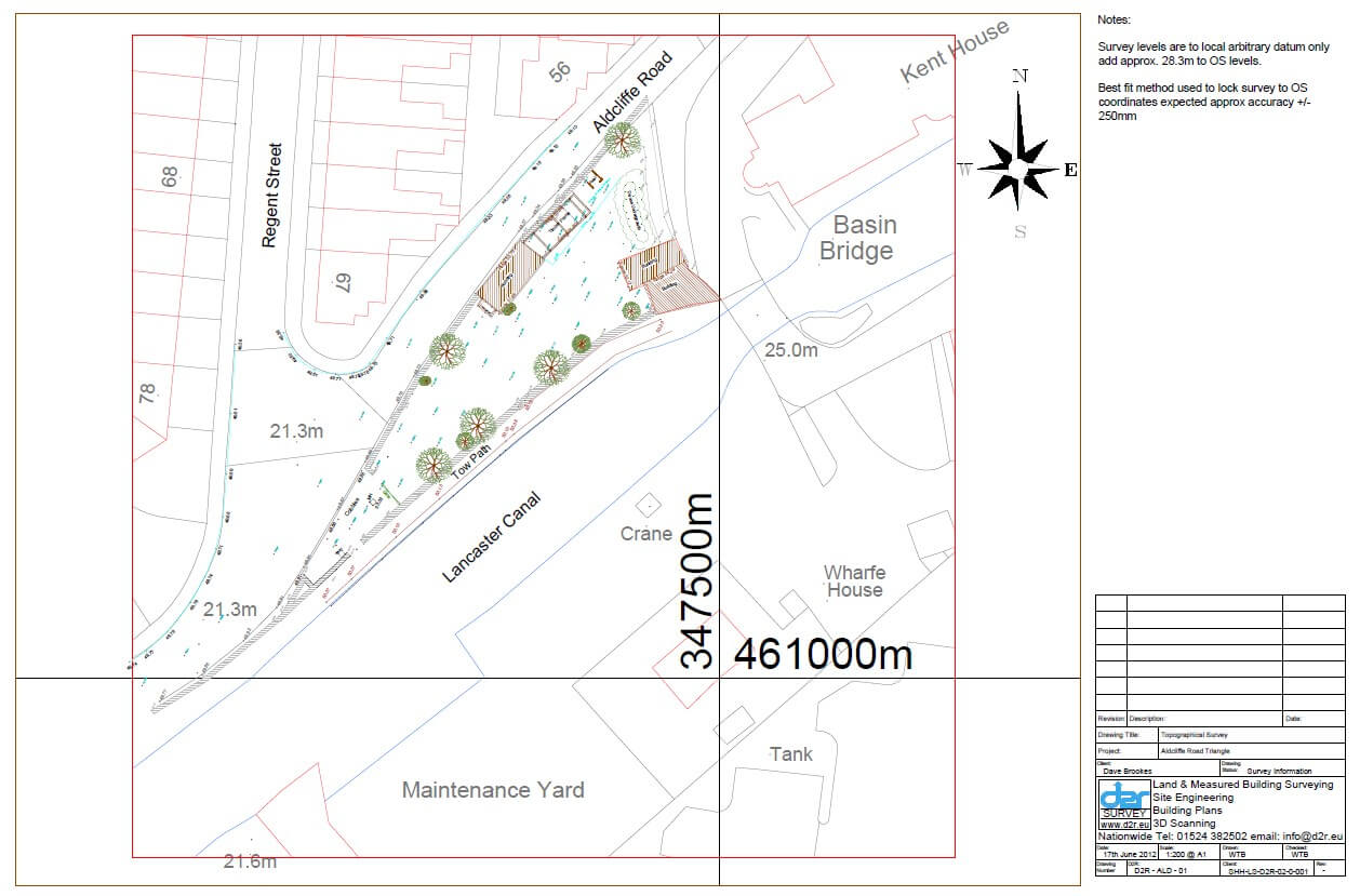
First look in 2012
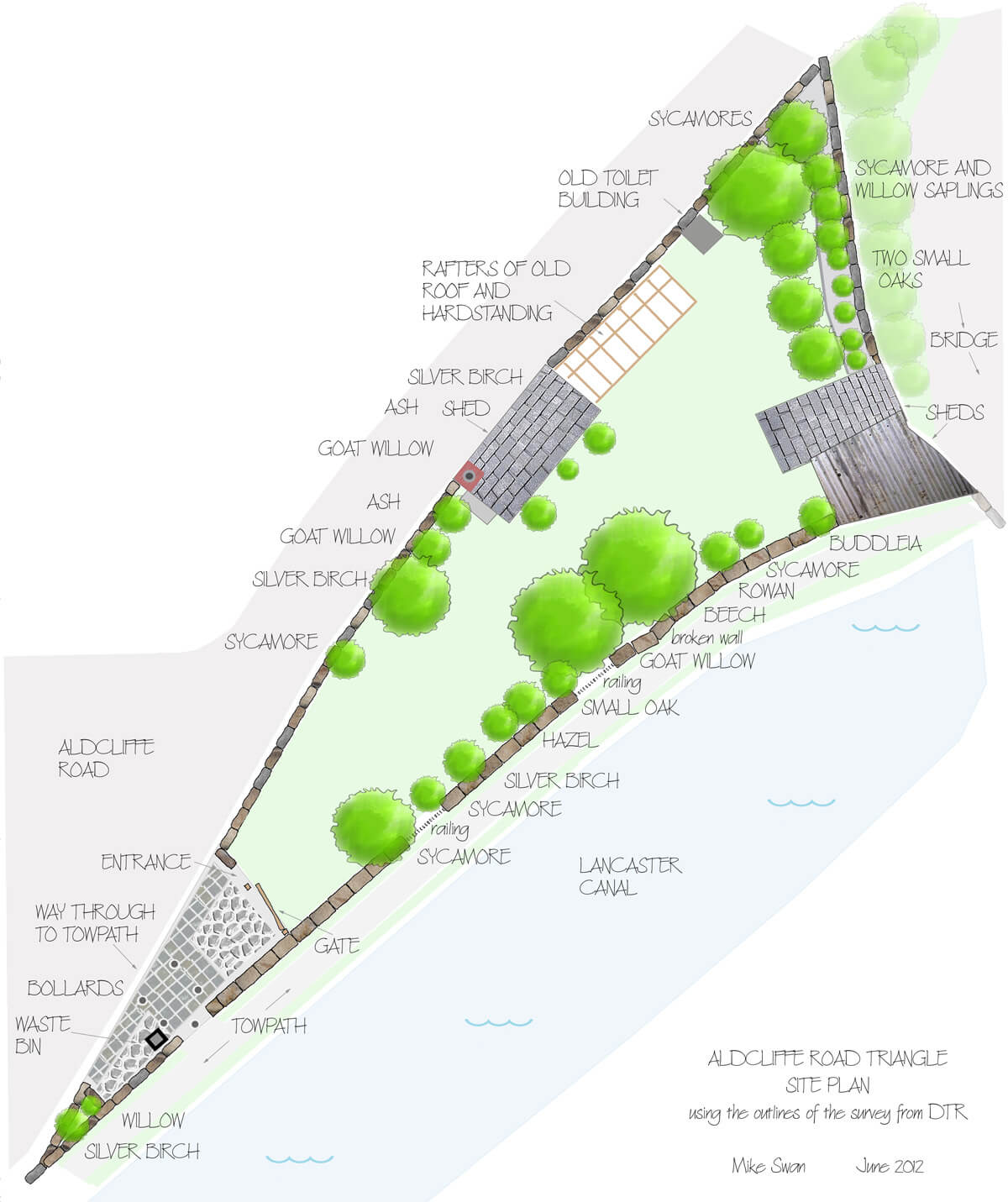
A survey of the site was carried out in June 2012. Here is the result.
Proposals
– Demolish former toilet and lean-to buildings at rear of site (possibly re-using bricks for raised beds?)
– Retain and repair central building for use as toolshed/workshop/other?
– Repair, reduce height of towpath boundary wall and reinstate former access point(s) including gates to match railings. See the document Works to Towpath Wall.
– Use timber frame structure as arbor/pergola for growing (grape?) vines
– Restore cobbled areas
– Some wildflower areas, bulb planting etc
– Fruit bushes (possibly in raised beds)
– Some element of tub gardening on concrete area under pergola and elsewhere?
– Paths (using bricks from demolition?)
– Natural play features?
– Notice board
– Compost/leaf mould heap
– Water butt
Challenges include:
– Ground may be almost all hard material under nominal 2″ soil cover
– Almost certainly some contamination to be dealt with
– Site has been used for drug taking and in some areas soil will need to be removed to ensure site is safe.
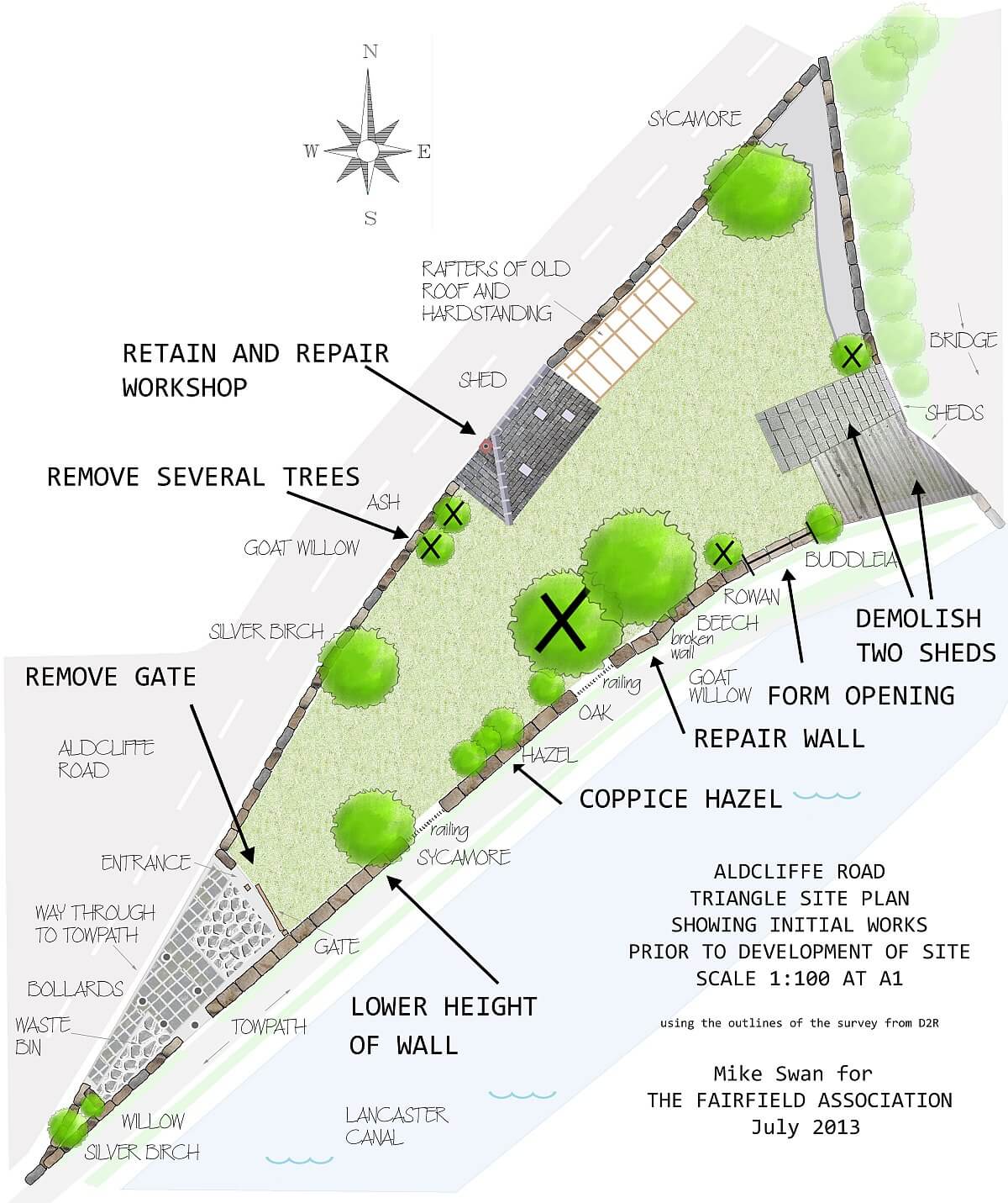
We consulted with the public using questionnaires at our summer fairs from 2012 to 2014 and using an online questionnaire on this website. There was strong support for our proposals and we pressed ahead.
Plans
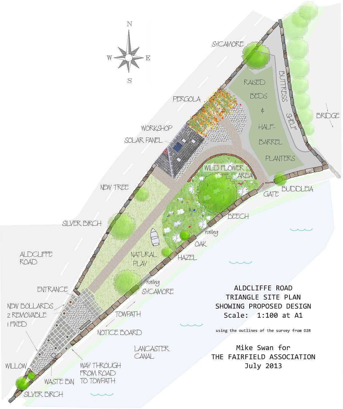
In June 2013 we arrived at a proposed design taking into account the input from the questionnaires, also from design students – two French garden design students whom we met in 2012 and Sara Haynes from Myerscough College.
There were still questions yet to be decided upon: what exactly to plant in the raised beds, what the path should be made of, what the raised beds should be made of, whether to have seating, how the workshop will be used. We planned not to have electricity / gas / running water / sanitation on the site.
This was the plan.
2014
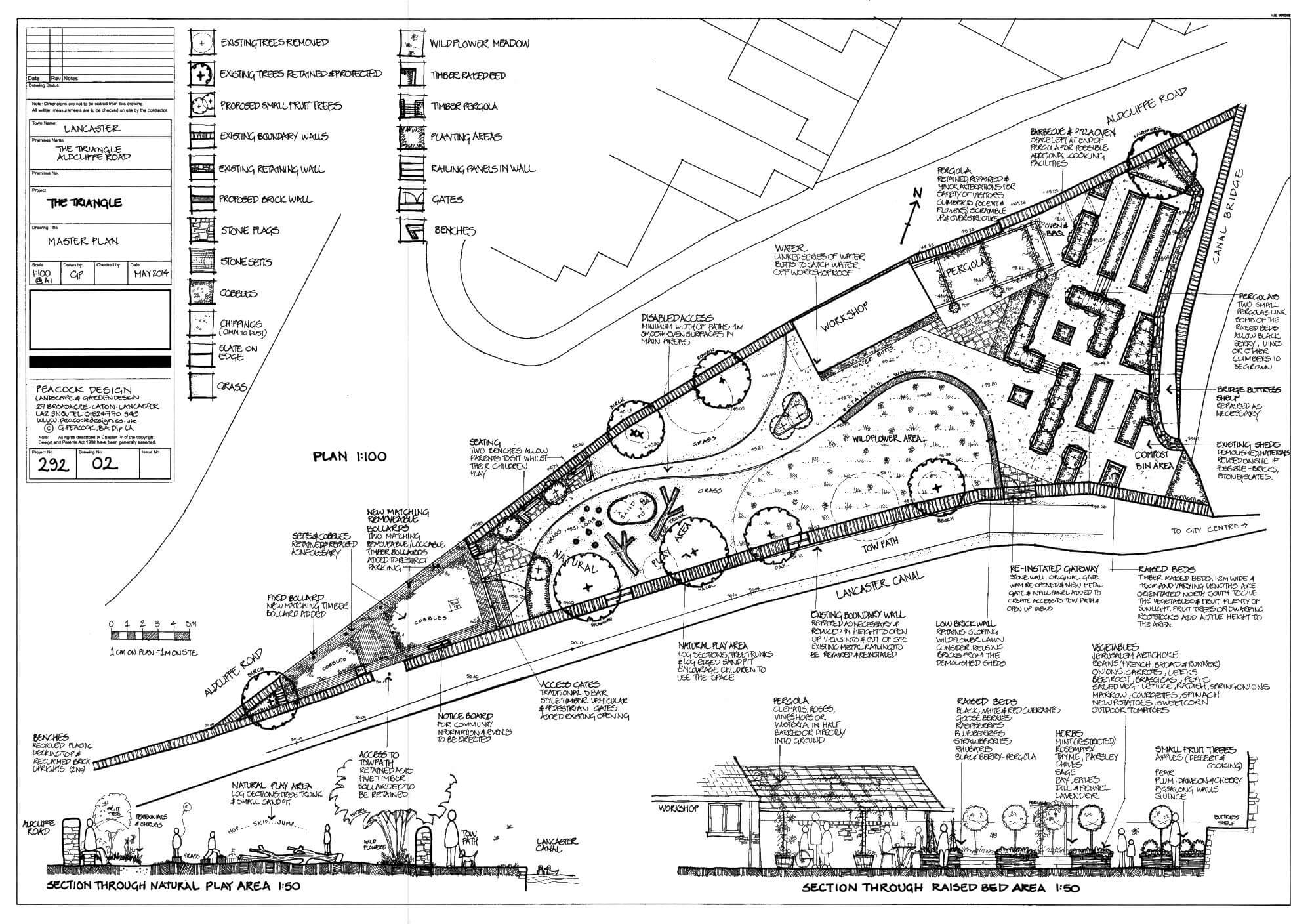
Georgina Peacock of Peacock Design was commissioned to produce a design for us which is shown here.
This is the amended version of September 2014 for submission to the Council Planning Department.
2014: we demolished the lean-to buildings.
2015: We lowered the towpath wall, invited Rolande the chainsaw carver to turn the goat willow into an owl, the rowan into a kingfisher, and use the spare wood for the new bench.
2016: We constructed the raised beds.
2017: We filled the raised beds with soil and began planting.
2019: We completed the work on the irrigation system.
All these exploits and many more are described in the Triangle News Archive pages, and illustrated in the Triangle Gallery.

